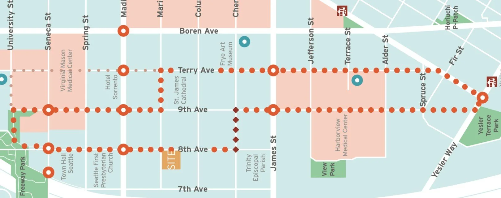
Park to Park: Walking Loop
THE MAP
Download the map, take the walk, and re-discover First Hill!
First Hill remains short of our parks and public open space goals by several acres, making every square foot of the public realm an important part of creating a healthy, green, and lush environment for all.
In 2017, FHIA outlined a 1.5 mile urban walking path between the existing 5.2 acre Freeway Park to the 1.7 acre Yesler Terrace Park called The Park to Park. This Walking Loop connects these important park spaces along our neighborhood greenways of Terry and 8th Avenues, creating a beautiful and safe walking route that showcases the many of the neighborhood’s unique amenities such as Free Little Libraries, public art installations, and benches.
The Street Concept Plan
FHIA continues to advocate and plan for capitol improvements along the Park to Park pathway through the development of a street concept plan. Such plans act as guides for improvements to streets and sidewalks that can be implemented over time with new development.
This street concept plan initiative builds on the Public Realm Action Plan from 2015, with the goal of the Walking Loop concept plan to safely and thoughtfully connect Freeway Park to Yesler Park through improvements along the streets and sidewalks such as wayfinding, public art, street trees, lighting, and the creation of green spaces.
In 2024, FHIA’s Urban Design & Public Space Committee acted as the steering committee for this project. You can review the details of the work here. The committee’s work will result in a concept plan in April of 2025 to guide street improvements and adjacent developments into a public benefit for everyone.